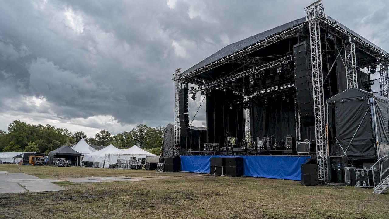
A good festival weather forecast does more than say whether it will rain. It tells you what is likely to happen at your site, when it will arrive, how confident the forecaster is, and which decision each answer should trigger. The organizers who handle severe weather well pair a forecast with a written plan, named decision-makers and thresholds agreed before the gates open. This guide walks through that process, from the first look at the extended outlook to the all-clear.
TL;DR
- Monitor the hazards that actually hurt crowds: lightning, high wind, thunderstorms, flooding, tornadoes and extreme heat, plus fog or wintry weather in the right season.
- Point-specific National Weather Service (NWS) forecasts reach seven days out, and uncertainty grows with distance, so plan in stages and update often.
- Set thresholds in advance and tie them to the time it takes to alert, shelter or clear your site.
- Separate the person who watches the weather from the person with authority to stop the show, and name both in writing.
- The NWS generally does not issue site-specific forecasts for event organizers, which is where a private consulting meteorologist fits.
Table of Contents
- What a festival forecast has to do
- The hazards to monitor
- How far ahead you can trust the forecast
- Turning a forecast into thresholds
- What the written weather plan should contain
- Communicating as conditions change
- Documenting forecasts and decisions
- Where public forecasts stop and a meteorologist starts
- Our perspective
- Weather support for your festival
- FAQ
- Sources
What a festival forecast has to do
A public forecast for the nearest city describes a region. A festival happens on one field, one waterfront or one fairground, with a stage structure, vendor tents, a crowd that cannot move quickly and a schedule that cannot easily be rearranged. The forecast you need answers operational questions: When could the first storm cell reach the site? Will gusts exceed what the rigging is rated for? Will the heat index climb during the headline set?
The Yourope toolbox, written for festival organizers, makes the point that forecasts carry probabilities rather than guarantees, and that conditions on the grounds can differ from regional warnings. It also stresses that forecasts, radar imagery and lightning alerts are only useful if they trigger the right actions at the right time. That is the standard to hold any festival forecast to: does it change what someone does?
The hazards to monitor
The NWS Event Ready Guide identifies lightning, flooding, high wind, thunderstorms and tornadoes as potential outdoor-event hazards, and notes that fog, heat or wintry weather may matter depending on the season and the event. The American Meteorological Society adds that lightning, wind gusts, extreme heat, hail, flooding, tornadoes and hurricanes have all caused fatalities or injuries at summer events.
Not every hazard applies to every festival. A practical way to sort them is by what each one threatens:
| Hazard | What it threatens | What to watch |
|---|---|---|
| Lightning and thunderstorms | Crowd safety, stage crew, power distribution | Storm distance and speed, lightning detection, timing of arrival |
| High wind and gusts | Stages, video walls, tents, signage, trussing | Sustained wind and peak gusts at structure height |
| Heavy rain and flooding | Parking, access roads, campsites, low-lying fields | Rainfall rates, creek and drainage conditions, soil saturation |
| Extreme heat | Attendee health, medical capacity, water supply | Heat index, overnight lows, hours of direct sun |
| Tornadoes | Everything, with very short warning | Watches, warnings, supercell potential |
| Fog or cold | Visibility, transport, load-in and load-out | Visibility trends, wind chill, precipitation type |
A site that floods in a two-inch rain needs a different plan from a hilltop that is exposed to wind. Start with the climate profile of your location and month, then layer the live forecast on top of it.
How far ahead you can trust the forecast
The NWS states that its point-specific forecasts go out seven days, and that uncertainty is generally higher farther out. For an event that might sit near a critical threshold, it recommends contacting the local weather service office to speak with a forecaster about confidence, timing and trends.
Switzerland's national weather service describes the same logic from the probabilistic side: its forecasting approach is ensemble-based and must consider a variety of possible scenarios, and it cautions that for thunderstorms in particular, a single model animation shows only one solution without displaying the uncertainty around it. Organizers should be wary of a screenshot of one model run.
A staged rhythm works well in practice:
- Weeks out: study the climatology for the site and date. This sets your baseline risks and your equipment and insurance decisions. No daily forecast is reliable yet.
- Five to seven days out: pull the extended forecast and look for the probability of severe weather rather than a single predicted outcome. Brief your core team on the likely scenarios.
- Two to three days out: firm up staffing, shelter readiness and structure inspections. Confirm who is on call and how decisions will be relayed.
- The day before: shift to short-range guidance. Decide which contingency levels are in play and tell department leads.
- Event day: brief at least twice, once before crew call and once before gates, then monitor continuously with short-range nowcasting.
The point of the staged approach is that each step has a purpose. Early forecasts support preparation, and later ones support timing.
Turning a forecast into thresholds
A threshold is a number or an official alert that, once crossed, starts a defined response. The NWS Weather Prepared checklist for a concert venue says plans should include triggers and procedures, where triggers can be NWS watches, warnings or advisories, or specific values such as 50 mph wind gusts. It adds that a plan may use more than one threshold to activate different levels of response.
Published examples show what this looks like on the ground:
- The NWS hazardous weather action plan template gives example triggers such as gusts over 30 mph prompting video walls and large speaker clusters to be lowered, and a heat index over 100°F prompting mandatory water breaks every 30 minutes.
- The City of Redmond, Washington guidance says sustained winds of 20 mph or more should lead to tents and temporary overhead structures being removed, and sustained winds of 35 mph or more should trigger a decision on postponing, delaying or cancelling.
Treat these as illustrations, not universal numbers. The right value for your stage depends on its engineering rating, your tent supplier's limits and the local authority's requirements.
Work backward from evacuation time
The most useful threshold is one built on how long your site takes to clear or shelter. The Event Ready Guide gives a formula: alert and activation time, plus evacuation or shelter time, plus a 25% safety factor. Its example: if it takes 30 minutes to alert and clear a venue and storms are 45 minutes away, the plan must be activated within the next 15 minutes.

Another NWS guide advises that sheltering and evacuation should be finished by the time a thunderstorm reaches an 8-mile radius around the venue. Put those together with your own numbers. A 20,000-person field with two exits and a campsite a mile away has a very different clearing time from a 2,000-person amphitheater with a covered concourse. A trigger that works for one would fail for the other.
What the written weather plan should contain
The NWS says plans should identify hazards, sheltering or evacuation options, alert methods and the time needed to notify people and move them to safety. The American Meteorological Society lists the practices it sees working: a professional meteorologist forecasting and monitoring the weather, a trained person in charge of weather decisions, a plan written and updated in advance, and designated nearest safe structures with ample time for patrons to reach them.
For live events, the Global Crowd Management Alliance identifies ANSI ES1.7-2021, Event Safety: Weather Preparedness as the principal American National Standard on the subject. It calls for an event-specific written plan covering site climate profiles, long-range and short-range forecasts, nowcasting, risk assessments, monitoring distances, action thresholds, show-stop and evacuation decisions, and coordination with forecasting services.
In plain terms, a plan that holds up should have these parts:
- Hazard assessment for the specific site and dates.
- Monitoring source and interpreter: one agreed feed of data, and one qualified person who turns it into a recommendation.
- Decision authority: a named person who can stop the show, separate from the person watching the data. Everyone should know who that is before the first act.
- Thresholds and actions at more than one level, from heightened awareness to full evacuation.
- Shelter locations and routes, with capacity matched to the crowd and the time to reach them.
- Resumption criteria: what conditions must be met before the program restarts, so that nobody improvises under pressure.
- Vendor, artist and contractor instructions, including who takes down what, and when.
The Yourope toolbox puts the common thread well: effective decisions under uncertainty require clear responsibilities, pre-defined thresholds, structured communication pathways and a shared understanding of what information means for each role.
Communicating as conditions change
A forecast that stays in the operations tent protects nobody. The NWS notes that pre-notification lets people prepare for something unusual, and that experience shows people respond more quickly to severe weather when they have been given a hint beforehand. It also recommends redundant communication with a consistent message.
The Yourope toolbox suggests a matrix of phase, channel and message so every stage and every team receives the same cue. Its phases run from a pre-alert for awareness, to pre-action with visible preparations, to firm protective instructions, to closures and alternative routes, and finally to an all-clear and staged restart. It recommends redundant channels such as PA, screens, app push, messaging apps and radio.
A few habits make this work:
- Give every department lead the forecast, the thresholds and their own duties before gates open, not after a warning is issued.
- Use the same wording on screens, stage announcements and staff radios. Mixed messages slow people down.
- Warn early and plainly. A message such as storms are expected near the site within the hour, move toward the marked shelter areas now, is more useful than a vague advisory.
- Update the team whenever the forecast changes, even if the change is that the threat has passed.
Documenting forecasts and decisions
If a festival is delayed, cut short or cancelled, someone will later ask what was known and when. Insurers, vendors, artists and sometimes attorneys will want the answer. Keep a running log that records the forecasts received and their times, observations at the site, who made each decision, and what evidence they used. Preserve warnings, communications, contracts and costs alongside it.
This record serves two purposes. It supports a claim if one is needed, and it shows that decisions followed a plan rather than a guess. Where a dispute arises, a certified consulting meteorologist can reconstruct conditions at the site after the fact. We cover that process in our guide to forensic meteorology services.
Where public forecasts stop and a meteorologist starts
Organizers sometimes assume the National Weather Service will provide a dedicated forecast for their event. Its policy directive says that NWS personnel generally will not provide specialized, site-specific forecasts or direct forecasting support to event organizers, and that enhanced support may come through private weather providers. The Storm Prediction Center says much the same: venue operators can use area public forecasts and outlooks, and some private forecasting firms may provide customized, event-specific guidance on thunderstorms and other hazards.
So the public forecast is your foundation, and a private meteorologist fills the gap above it. Consider that support when:
- Attendance is large, the site is hard to clear, or the event runs over several days.
- Structures such as stages, video walls or tents are sensitive to wind.
- The schedule is tight enough that a one-hour timing error matters.
- Your insurer, venue or local authority expects a documented weather process.
- The forecast sits near one of your thresholds and you need an expert read on confidence and timing.
On-site support puts a meteorologist in the operations team, interpreting radar, lightning data and local observations in real time and advising the person who holds stop authority. For events that do not need someone on the grounds, remote briefings the day before and the morning of the event can cover the same decisions. Our broader guide to severe weather planning covers how to build this into a wider risk program.
Our perspective
The most common failure we see is not a bad forecast. It is a good forecast that no one was authorized to act on. A festival weather process has three jobs: watching the weather, interpreting what it means for this site, and making the call. When those jobs live in a group chat, nobody owns them.
That is why we work as consulting meteorologists rather than data providers. A certified consulting meteorologist (CCM) explains the implications for your stage, your crowd and your schedule, so the decision-maker can act with confidence instead of staring at a radar loop. Raw data tells you a storm exists. Analysis tells you when it reaches your gate, how strong the gusts will be at truss height and how much margin your evacuation plan leaves.
We built our service around speed and access. Same-day analysis matters when a forecast shifts the night before a festival, and direct access to a meteorologist matters when a cell develops during the afternoon. Our event forecasting is designed to be customized to your site, your thresholds and your team, and the same expertise carries over if an insurance or legal question follows. Our guide to what a certified consulting meteorologist does explains the credential.
Weather preparedness is a responsibility, not an extra. Plan early, set your triggers before you need them, and put a qualified person beside the people who make the call.
Michael
Weather support for your festival
Wxprep provides event forecasting, on-site meteorology support, risk mitigation and emergency weather planning for organizers, along with forensic reports and expert witness services when a weather event leads to a claim or dispute. Our consulting meteorologists can help you set site-specific thresholds, brief your team and advise in real time on event day, with same-day analysis available when timing is tight.

See the full list of event forecasting and risk services or reach out through our home page to discuss your event.
FAQ
How far in advance can I rely on a festival weather forecast?
Point-specific NWS forecasts extend seven days, and uncertainty is higher the farther out you look. Use the first days of that window for probabilities and preparation, and rely on short-range forecasts and nowcasting for timing decisions the day before and the day of the event. If your event sits near a critical threshold, talk with a forecaster about confidence, timing and trends.
What wind speed should trigger action at an outdoor festival?
There is no single number, because it depends on your structures and their ratings. As published examples, Redmond, Washington guidance calls for removing tents at sustained winds of 20 mph or more and evaluating a postponement at 35 mph or more. An NWS template example lowers video walls at gusts above 30 mph. Set your own values with your stage engineer and a meteorologist.
Can the National Weather Service give my festival a dedicated forecast?
Generally no. The NWS directive says its personnel will not usually provide specialized, site-specific forecasts to event organizers, and points to private weather providers for enhanced support. You can still use its public forecasts, watches, warnings and outlooks, and many local offices will discuss an event that is near a threshold.
Who should be allowed to stop the show for weather?
One named person with clear authority, documented before the event and separate from whoever monitors the data. The monitor and a qualified interpreter advise, and the decision-maker acts. The plan should also state the conditions that allow the show to restart, so the all-clear is not a debate.
When is on-site meteorological support worth it?
It is most useful for large or multi-day events, sites that take a long time to clear, wind-sensitive structures and tight schedules. It also helps when an insurer or authority expects a documented weather process. A meteorologist in your operations team can interpret changing conditions and advise the decision-maker in real time.
Sources
- NWS Event Ready Guide
- American Meteorological Society: Weather Safety at Summer Events
- MeteoSwiss: Weather advice for outdoor events
- NWS Weather Prepared Checklist: Event Pavilion / Concert
- NWS Blank Hazardous Weather Action Plan
- City of Redmond: Weather Monitoring Guide for Outdoor Events
- NWS Weather Watcher Guide
- Global Crowd Management Alliance: Weather Planning Resources
- Yourope Weather Preparedness and Resilience Toolbox
- NOAA/NWS Policy Directive on support to event organizers
- NWS Storm Prediction Center: Proactive or Reactive